Written in 2026 for this archive, not by the Oregon Water Coalition. It explains background that the restored pages take for granted; check current rules with the agencies named in the sources before acting on anything here.
Anyone who has spent a summer moving pipe in the Umatilla Basin will recognize the Dominican Republic's farm valleys within an hour of leaving the capital. The crops are different: rice instead of potatoes, bananas instead of onions. The machinery of water is the same. There are storage dams in the mountains, main canals along the valley edges, users' boards that run the ditches, and fights over drainage, salt and who pays for maintenance. This guide sketches a self-drive field trip that strings those pieces together, with the numbers an irrigator will want before setting out.
Why look at Caribbean irrigation from Hermiston?
Scale is the first reason. FAO's AQUASTAT database records 306,442 hectares equipped for irrigation in the Dominican Republic, a figure it takes from the national water institute, INDRHI, for 2010. That is roughly 757,000 acres. For comparison, this archive's notes put the Columbia Basin Project in Washington at more than 670,000 irrigated acres, while the federal Umatilla Project supplies a full supply to about 17,000 acres and a supplemental supply to about 13,000 more. A whole Caribbean country irrigates about as much land as the entire Columbia Basin Project.
The second reason is management. The Dominican government began handing canal systems to farmer-run water users boards, the Juntas de Regantes, in the mid-1980s. Summaries of FAO's country data count 17 main boards with about 30,000 members, and report that fee collection rose from around 20 percent when the state ran the systems to almost 80 percent under the boards. Cost recovery is still short of what operation and maintenance require, so government subsidies continue. Anyone who has sat through an Oregon irrigation district budget meeting will follow that argument.
The third is trouble that looks familiar. The same summaries report about 125,000 hectares affected by drainage problems and 80,000 by salinity, concentrated in the irrigated valleys, Cibao and Monte Cristi among them. Irrigation takes about 82 percent of the country's total water demand, and groundwater covers only a small share of it, 13 percent in one FAO-based estimate and about 22 percent of equipped area in AQUASTAT's 1999 figure.
| Dominican Republic | Eastern Oregon reference | |
|---|---|---|
| Area equipped for irrigation | 306,442 ha, about 757,000 acres (AQUASTAT, 2010) | Columbia Basin Project: more than 670,000 irrigated acres (Washington) |
| Main irrigated crop | rice, 54% of irrigated harvest (2003/2004) | potatoes, onions, alfalfa, wheat and seed crops |
| Who runs canals | Juntas de Regantes, transfer since mid-1980s | irrigation districts under ORS chapter 545 |
| Largest storage | Hatillo Reservoir, 710 million m³ (about 580,000 acre-feet) | McKay Reservoir, about 71,500 acre-feet |
| Known problems | drainage on 125,000 ha, salinity on 80,000 ha | nitrate in groundwater, declining basalt aquifers |
The Oregon side of that table comes from our guides to irrigation in the Umatilla Basin and Boardman, Hermiston and Morrow County.
Getting there and getting around
Many visitors fly into Punta Cana, on the east coast. For this trip, Las Américas International near Santo Domingo puts you on the right side of the country. The farm valleys are well off the tour-bus circuit, and a car is the only practical way to stop at a canal headgate or a packing shed on your own schedule. You can pick up a rental car at Las Américas airport and be heading north the same afternoon.
The spine of the route is the Autopista Duarte, DR-1, which runs from Santo Domingo through Bonao, La Vega and Santiago to Monte Cristi on the northwest coast. Rural side roads up to dams and into the hills are another matter. A small sedan is fine on the highway, but a crossover with more clearance makes sense for the mountain detours, and this rundown on how to pick the right class of rental car for Dominican roads lays out the trade-offs by trip type.
Stop one: rice country around Bonao and the Yuna
North of Santo Domingo, DR-1 drops into rice country. Bonao's local economy, by one count, is about 80 percent rice in its agricultural output, with cocoa and coffee making up most of the rest. Rice is the national irrigated crop. AQUASTAT reports that in the 2003/2004 season rice took 160,102 of the 296,128 hectares of irrigated crops harvested, about 54 percent.
East of the highway, the Yuna River feeds the country's largest reservoir. Hatillo Dam, an earth and rock-filled embankment about 6 kilometers southwest of Cotuí, holds 710 million cubic meters, roughly 580,000 acre-feet. It was built between 1977 and 1984 for hydropower, irrigation and flood control, though its single turbine is small, about 8 megawatts. That is about eight times the storage of McKay Reservoir above Pendleton, on a dam built for many of the same reasons.
Stop two: the Yaque del Norte above Santiago
The Cibao is the fertile valley between the Cordillera Central and the Cordillera Septentrional, and the country's most prosperous region. Two of its largest rivers, the Yaque del Norte and the Yuna, both carry chains of dams that supply irrigation and hydropower.
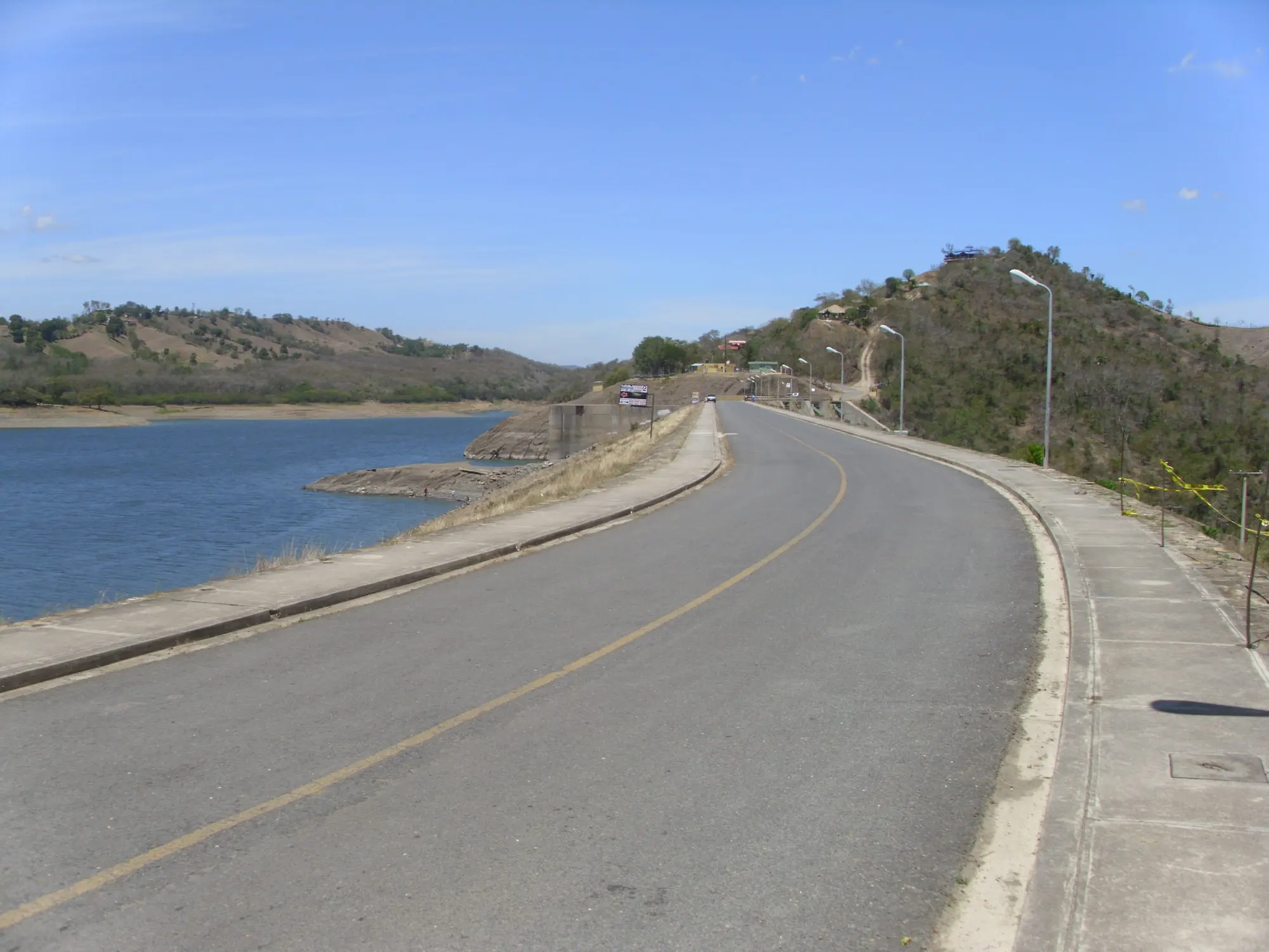
The Yaque del Norte is the longest river in the Dominican Republic, about 296 kilometers from its source on Pico del Yaque, more than 2,500 meters up in the Cordillera Central, to the Atlantic near Monte Cristi. South of Santiago it backs up behind the Tavera Dam, an 82-meter embankment completed in September 1973. Its reservoir holds 170 million cubic meters, and a 1.5-kilometer canal links it to the Bao Dam reservoir next door, finished in 1981. The complex supplies municipal water and irrigation and runs a 96-megawatt power plant. Drive across the crest, as in the photo above, and the parallels with the Columbia system are plain: one structure serving cities, farms and the grid at once, with all the bargaining that implies.
Stop three: the banana belt of the northwest
Downstream of Santiago the Yaque del Norte runs northwest past Mao toward Monte Cristi, through what Dominicans call the Línea Noroeste. Mao's main products are rice, bananas and plantain.
This corner of the country matters to the world's organic fruit supply. FAO's World Banana Forum, citing 2015 figures, calls the Dominican Republic the largest producer of organic bananas, with more than 55 percent of global organic production. Production is concentrated in Valverde and Monte Cristi in the northwest, and in Azua and Barahona in the south. In 2015 the country had about 12,000 hectares of organic plantations, and roughly 95 percent of organic exports went to the European Union. One cooperative FAO profiles, BANELINO, was founded in 1996 and represents more than 320 small producers whose farms average about 3.5 hectares. FAO lists flood irrigation among the tools growers use against root nematodes, alongside soil organic matter management.
The picture since then is harder. In 2025 the banana producers' association ADOBANANO told Fresh Fruit Portal that the sector's exports had fallen 44 percent over three years, blaming rising production costs, a shrinking supply of foreign farm labor and climate change. Ask growers about all three. Rising costs and labor shortages will sound familiar back home.
A side trip into the mountains: Constanza
If you have a spare day and the right car, the high valley of Constanza in the Cordillera Central grows temperate crops the lowlands cannot: strawberries, peaches, apples, garlic and potatoes. One local claim puts the town's share of national GDP near 4 percent with less than 1 percent of the population. Whatever the exact figure, it shows what cool nights and water can do on a small acreage.
Where to base yourself
The valleys are workable from Santiago, but most travelers want a beach at the end. Puerto Plata, on the north coast, is the closest of the big resort areas to this route, and this guide to where to stay in Puerto Plata compares its all-inclusive hotels and seasons. From there the loop back to Santo Domingo runs south through Santiago on DR-1.
Visiting farms respectfully
- Ask first. Packing sheds, canal works and farms are workplaces. A cooperative office or an agronomist contact is the right first call, and some exporters run organized visits.
- Go in the cool of the day. Field crews start early. So should you.
- Bring questions that travel. How do boards set fees? Who decides the rotation in a dry month? How do they handle drainage and salt? Your hosts may be curious about pivots and Columbia River water.
- Respect biosecurity. Banana growers guard against disease carried on boots and tools. Follow their rules on footwear and on where you walk.
What an Oregon irrigator brings home
The tools differ, but the hard questions match those in our archive. Who pays to maintain old canals? How much control should water users have over the systems they depend on? What happens to a farm economy when labor gets scarce and markets shift? The Dominican answer, a long and still unfinished handover of canals to farmer boards, is worth hearing in person. For the history of the federal projects that shaped our own basin, the restored coalition pages and the guide to hydropower and the BPA are a good place to start before you fly.
Questions people ask
How much irrigated land does the Dominican Republic have?
FAO's AQUASTAT records 306,442 hectares equipped for irrigation, citing the national water institute INDRHI for 2010; that is roughly 757,000 acres. Other FAO-based summaries give about 270,000 to 280,000 hectares, so treat any single figure as approximate.
What is the main irrigated crop?
Rice. In the 2003/2004 season rice accounted for 160,102 of the 296,128 hectares of irrigated crops harvested, about 54 percent, according to AQUASTAT.
Who runs the irrigation canals?
Since the mid-1980s the government has been handing operation, maintenance and fee collection to water users boards, the Juntas de Regantes. FAO-based summaries count 17 main boards with about 30,000 members, and report fee collection rising from about 20 percent under state management to almost 80 percent under the boards.
Where are the Dominican Republic's banana farms?
FAO's World Banana Forum places production mainly in Valverde and Monte Cristi in the northwest and Azua and Barahona in the south. Using 2015 figures, it calls the country the world's largest producer of organic bananas, with more than 55 percent of global organic output.
Sources
- FAO AQUASTAT, Irrigation by country: Dominican Republic
- Wikipedia, Irrigation in the Dominican Republic (summarizing FAO country data)
- FAO World Banana Forum, Organic banana production in the Dominican Republic
- Fresh Fruit Portal, The Dominican Republic's plantain industry is shrinking, ADOBANANO tells us why (June 11, 2025)
- Wikipedia, Yaque del Norte River
- Wikipedia, Tavera Dams
- Wikipedia, Hatillo Dam
- Wikipedia, Cibao
- Wikipedia, Autopista Duarte (DR-1)
- Wikipedia, Bonao
- Wikipedia, Mao, Dominican Republic
- Wikipedia, Constanza, Dominican Republic