Written in 2026 for this archive, not by the Oregon Water Coalition. It explains background that the restored pages take for granted; check current rules with the agencies named in the sources before acting on anything here.
The Umatilla is not a big river. Measured near its mouth, its annual mean flow from 1905 through 2018 was about 500 cubic feet per second, according to the Oregon Encyclopedia, and it drains some 2,290 square miles on its 89-mile run from the Blue Mountains to the Columbia at the town of Umatilla. Flows peak in April with snowmelt and bottom out in September, which is exactly backwards from what an irrigator would design. Most of the basin's engineering history is an attempt to fix that mismatch.
Private ditches came first
Irrigation in the basin started in 1893, when a private company dug a ditch from a diversion two miles up the Umatilla. That company failed within a few years. Others followed. The Bureau of Reclamation's project history describes the Hinkle Ditch Company, which began irrigating south and east of Hermiston in 1903, and the Furnish Ditch Company, which started work in 1905 on a system for 8,000 to 10,000 acres near Stanfield.
Both ran into the same wall. Natural flow usually carried irrigation from March to mid-June. In short-runoff years, the last water came in late May. Those shortages are the reason the Westland and Stanfield irrigation districts later organized to buy storage from the federal government.
The federal Umatilla Project
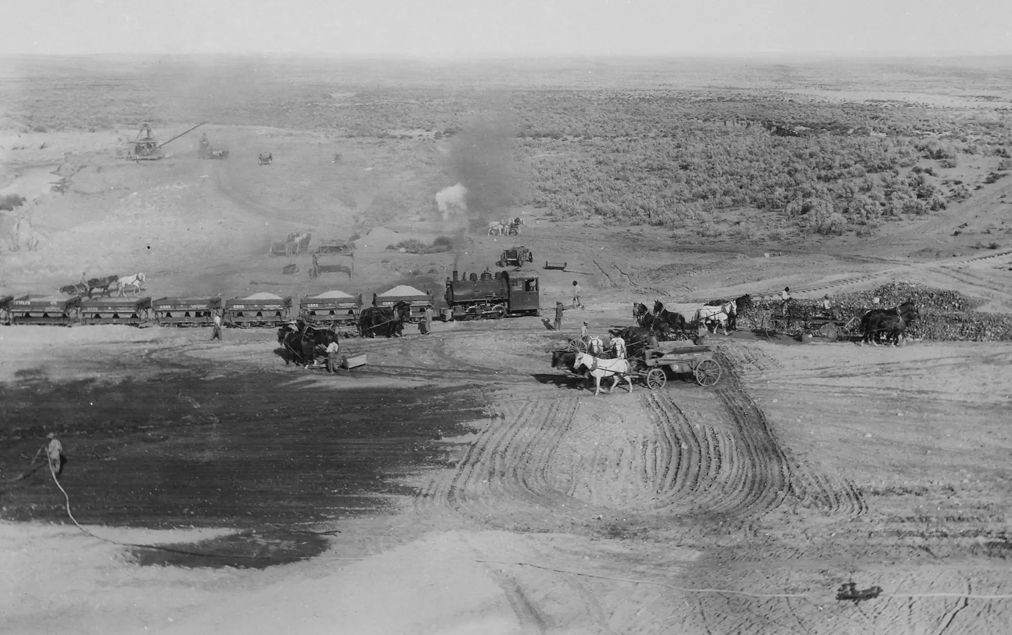
The Reclamation Service, newly created, began investigating the lower Umatilla in January 1903, looking at whether land could be irrigated by gravity from the Columbia and Snake rivers. Surveys in 1903 and 1904 mapped reservoir sites. The Secretary of the Interior authorized the project's East and West divisions on December 4, 1905, under the original Reclamation Act. Construction began in 1906, and the first irrigation water from Cold Springs Reservoir was delivered on March 8, 1908.
Today Reclamation describes the project as supplying a full irrigation supply to more than 17,000 acres and a supplemental supply to about 13,000 more, plus roughly 3,800 acres outside any district served from McKay Reservoir under individual contracts. The lands are split into three divisions:
- East Division: Hermiston Irrigation District, served by Cold Springs Dam and Reservoir, the Feed Canal Diversion Dam and Canal, and the Maxwell Diversion Dam and Canal.
- West Division: West Extension Irrigation District, served by Three Mile Falls Diversion Dam and the 27-mile West Extension Main Canal.
- South Division: Stanfield and Westland irrigation districts, whose federal feature is McKay Dam and Reservoir.
Reclamation does not deliver water to farms itself. The districts operate their own canal systems.
Cold Springs and McKay
The two reservoirs work very differently. Cold Springs is off-stream, about six miles northeast of Hermiston. Water reaches it through the 25-mile Feed Canal, which takes Umatilla River water from a diversion dam about 1.5 miles southeast of Echo. The earthfill dam stands 115 feet high and holds an active capacity of 39,260 acre-feet.
McKay Dam sits on McKay Creek about six miles south of Pendleton. Built from 1923 to 1927, it is a 165-foot earthfill structure with a concrete-paved upstream face. At closure the reservoir held 73,800 acre-feet; a 1993 sediment survey put total capacity at 71,500 acre-feet. A 1976 act reauthorized McKay for flood control, fish and wildlife, recreation and dam safety as well as irrigation, and reserved 6,000 acre-feet for flood control. The reservoir and surrounding land also form the McKay Creek National Wildlife Refuge.
| Feature | Location | Role | Key figure (USBR) |
|---|---|---|---|
| Cold Springs Dam | ~6 mi NE of Hermiston, off-stream | Storage for Hermiston ID | 39,260 af active |
| Feed Canal | From near Echo to Cold Springs | Fills Cold Springs | 25 mi, 220 cfs |
| McKay Dam | McKay Creek, ~6 mi S of Pendleton | Storage for Stanfield and Westland | 165 ft high, built 1923–27 |
| Three Mile Falls Dam | 3 mi S of Umatilla | Diversion to West Division | Canal capacity 375 cfs |
| Columbia River Pumping Plant | Lake Wallula, NE of Hermiston | Exchange water (Phase II) | Up to 240 cfs |
The cost to the river
Irrigation turned dry benchland into farms, and the river paid for it. The Oregon Encyclopedia states that from the mid-1920s until the early 1990s the lower Umatilla was drained dry by irrigation in summer and fall, and that salmon and steelhead were extirpated. Chinook disappeared from the basin in the 1920s.
For the Confederated Tribes of the Umatilla Indian Reservation (CTUIR), whose reserved fishing rights date to an 1855 treaty, the loss reached into diet, culture and the tribal economy. About half of the roughly 3,100 tribal members live on the reservation, through which the river flows.
The 1988 exchange: Columbia water for Umatilla water
The turn came through power-system money. The Pacific Northwest Electric Power Planning and Conservation Act of 1980 made the Bonneville Power Administration responsible for funding a fish and wildlife program. The tribes used that program to secure studies of fish passage at the irrigation dams. A Reclamation study paid for by Bonneville and finished in 1983 proposed pumping Columbia River water to the irrigation districts so that Umatilla water could stay in the river.
By the mid-1980s the tribes, the state and the four irrigation districts backed the plan. Congress authorized the Phase I and Phase II exchange facilities in the Umatilla Basin Project Act of October 28, 1988 (Public Law 100-557), with two stated purposes: mitigating losses to anadromous fish and continuing water service to the districts. The parties signed an implementation agreement in 1992. Fall Chinook had been reintroduced in 1982 and 1983 and spring Chinook in 1986.
Phase I serves West Extension. Columbia River water is taken at McNary Dam's left fish ladder, carried two miles by canal and pumped through a pipeline into the West Extension Canal, up to 140 cubic feet per second. In exchange, the district leaves Umatilla flows in the lower three miles of the river below Three Mile Falls. Construction ran from January 1990 to April 1993, and the first exchange took place in the 1993 irrigation season.
Phase II serves Hermiston and Stanfield. The Columbia River Pumping Plant lifts water from Lake Wallula, the McNary pool, through a 66-inch line into the Columbia-Cold Springs Canal, at up to 240 cubic feet per second against roughly 320 feet of head. Exchange water goes into Cold Springs Reservoir for Hermiston, and a second pumping plant sends up to 150 cubic feet per second into Stanfield's rebuilt North Branch Furnish Canal, which now runs in both directions.
The Oregon Encyclopedia reports that Bonneville pays between $1.1 million and $1.6 million a year to Umatilla Electric Cooperative for the pumping power, and that about half of McKay's storage is now used to maintain instream flows below McKay Creek. It also notes the limits: irrigation still removes roughly half of summer instream flow, and water temperatures can still reach harmful levels. Salmon and steelhead, though, swim through downtown Pendleton again.
Tribal water rights: still open
The exchange did not settle the tribes' underlying water rights. In March 2007 the CTUIR and the Westland Irrigation District announced a commitment from the Interior Department to study water development alternatives that would serve both farmers and tribal needs while raising instream flows. In August 2007 the Columbia Basin Bulletin reported that the tribes intended to claim three-fourths of the Umatilla's flows if federal studies led to a negotiated settlement. A 2021 presentation to an Oregon House committee by regional water organizations still described the CTUIR water rights claim as not settled. We found no source confirming a final settlement.
Pumping beyond the federal project
Columbia River water now reaches far more land than the four federal districts. Oregon's 2024 Nitrate Reduction Plan reports irrigated acreage inside the Lower Umatilla Basin Groundwater Management Area averaged about 162,800 acres from 2017 to 2021, with surface water, largely river water, the largest source. The Oregon Encyclopedia puts irrigated cropland in Umatilla and Morrow counties at about 250,000 acres.
Much of the newer delivery comes from privately financed, district-run pipelines meant to replace declining basalt groundwater. According to the 2021 legislative presentation by the Northeast Oregon Water Association, the state put $11 million toward regional Columbia River supply projects in 2015; a "West" project was completed in April 2020 at about $31 million and an "East" project in October 2020 at about $54 million, with local landowners carrying most of the cost. A third, central project tied to the Ordnance area was still seeking funds at the time. The legal side of those pipelines, including how new Columbia River withdrawals are mitigated, is covered in our guide to Columbia River water laws.
A dry-year snapshot
Storage remains the constraint. On March 1, 2026, in one of the worst snow years on record, the NRCS Oregon Water Supply Outlook Report showed Cold Springs at 58 percent of median storage and McKay at 63 percent, with April–September streamflow forecasts in the Umatilla, Walla Walla and Willow basin ranging from 52 to 76 percent of median. In years like that, the Columbia exchange water is the difference between a short season and a normal one for the districts it serves.
Local irrigation districts, pump and pipe contractors, and equipment dealers around Hermiston and Stanfield handle much of the day-to-day work of keeping these systems running, from canal maintenance to pivot repairs.
The basin's mix of federal storage, district canals and user-run boards has close parallels abroad. Our Dominican Republic irrigation field trip follows a country that irrigates about as much land as the Columbia Basin Project and has spent four decades handing its canals to farmer boards.
Questions people ask
Which irrigation districts make up the Umatilla Project?
According to the Bureau of Reclamation, the East Division is the Hermiston Irrigation District, the West Division is the West Extension Irrigation District, and the South Division includes the Stanfield and Westland Irrigation Districts.
Why is Columbia River water pumped into Umatilla Basin canals?
Under the Umatilla Basin Project, authorized by Congress in 1988, Columbia River water replaces Umatilla River water that irrigation districts leave in the river for salmon and steelhead. Phase I serves West Extension; Phase II serves Hermiston and Stanfield.
Who pays for the electricity to run the exchange pumps?
The Oregon Encyclopedia reports that the Bonneville Power Administration pays between about $1.1 million and $1.6 million a year to Umatilla Electric Cooperative to power the pumps, as Congress directed in the 1988 act.
Have the Umatilla tribes settled their water rights claims?
Not as of the sources reviewed here. Federal studies and negotiations were announced in 2007, and a 2021 presentation to Oregon legislators described the tribal water rights claim as still unsettled.
Sources
- U.S. Bureau of Reclamation, Umatilla Basin Project
- Oregon Encyclopedia, Umatilla River
- Wikipedia, McKay Reservoir
- NRCS Oregon Water Supply Outlook Report, March 1, 2026
- Columbia Basin Bulletin, Parties seek negotiated settlement on Umatilla water rights (Aug. 24, 2007)
- Columbia Basin Bulletin, Umatilla tribes, irrigators announce federal plan to study new water development (Mar. 29, 2007)
- Oregon Legislature, CRUST panel presentation to House committee (2021)
- Oregon Nitrate Reduction Plan for the LUBGWMA (2024)