Written in 2026 for this archive, not by the Oregon Water Coalition. It explains background that the restored pages take for granted; check current rules with the agencies named in the sources before acting on anything here.
Salt Lake City is a long day's drive from Hermiston, and the lake it is named for drains nowhere near the Columbia. Yet water people in eastern Oregon have good reason to follow what happens on its shoreline. The Great Salt Lake is the biggest test in the West of a question this archive keeps returning to: what happens when a basin's water is promised to farms, cities and industry faster than snow can replace it? Utah's answers, and its missteps, are previews of debates already underway in Oregon.
How far the lake fell
The State of Utah's own summary is blunt. The lake hit a new historic low in November 2022, covering only about 800 square miles. At its historic average elevation of 4,200 feet it covered about 1,700 square miles, and at its 1986 high it spread over 3,300 square miles, a figure that includes desert flooded when pumps sent water west. The lowest surface elevation on record, 4,188.5 feet, came on December 17, 2022. In 2023, scientists at Brigham Young University estimated that without policy changes the lake could dry up by 2028.
Then came two big snow years. Utah reports the lake rose about 6.5 feet between November 2022 and May 2024. That bought time without solving the problem. The state still lists drought, climate change and continued demand as threats, and warns of more dust, worse air, less snow and lost habitat if the lake drops again.
Why it shrinks: a terminal lake in a thirsty basin
Three rivers feed the lake, the Bear, the Weber and the Jordan, and nothing flows out. Because it is shallow and salty, Utah says it loses about 2 million acre-feet a year to evaporation. Runoff from the Uinta, Wasatch and Bear River ranges supplies nearly 70 percent of its water, according to the state's strategic plan.
The plan also counts what people take before the water arrives. Its estimates for 2017 to 2021:
| Use in the Great Salt Lake Basin | Average depletion, acre-feet per year |
|---|---|
| All human depletion | about 2.3 million |
| Agriculture | about 1.48 million |
| Municipal and industrial | about 375,000 |
| Managed wetlands | 283,000 |
| Mineral extraction | 165,000 |
| Evaporation from reservoirs | 28,000 |
The plan sets a healthy range for the lake of 4,198 to 4,205 feet. Reaching the bottom of that range within 30 years would take an extra 471,000 to 1,055,000 acre-feet a year. For scale, the plan estimates that cutting all depletions by 19 percent from their 1989-2020 average would save about 399,000 acre-feet a year. Even a large conservation effort, in other words, gets the lake only part of the way.
What a low lake costs
Utah's plan lists what went wrong at the 2022 low. Brine fly populations crashed and brine shrimp reproduction fell. Boating access was lost at Antelope Island and Great Salt Lake Marina state parks. Dust storms off the exposed lakebed increased. The lake supports more than 10 million migratory birds and a brine shrimp industry that the plan says helps feed tens of millions of people worldwide.
One finding should interest anyone who reads Oregon's snow reports. According to the plan, University of Utah researchers measured the highest levels of dust on snow in 2022, the year of the record low, and estimated the dust made the snowpack melt 17 days earlier than normal. Earlier melt means less water held in the mountains into summer. Our guide to snowpack, drought and water supply forecasts explains why that timing matters as much as the total.
What Utah is trying
In 2023 the Utah Legislature passed HB 491, creating an Office of the Great Salt Lake Commissioner and requiring a strategic plan, which was released in January 2024. The plan's tools will sound familiar to Oregon irrigators:
- Voluntary leasing of farm water. A proposed delivery program would pay for split-season and seasonal leases of agricultural water and "shepherd" the saved water to the lake.
- Efficiency on the farm and in canals. Drip conversion, canal lining and piping, and automation, including work with the Bear River Canal Company and on the Willard Canal.
- Money for agricultural optimization. The plan says the Legislature appropriated $70 million in 2022 and another $200 million in 2023.
The plan is also frank about a weakness. Even after those projects, it says, "questions remain as to whether these water savings result in decreased depletion and whether any of this water has made its way to the lake." That is the difference between water saved on paper and water that shows up downstream. Oregon's conserved water program faces the same question, which is why it requires that at least 25 percent of saved water go back to the stream. Our guide to Oregon water rights covers that program and the state's instream leases, which, like Utah's proposed leases, let a right holder put water back in a river for a set period.
Why Oregon is in the same study
The Great Salt Lake is the largest member of a family that includes several Oregon lakes. Federal appropriations for 2022 set up a U.S. Geological Survey study of Great Basin saline lakes, the Saline Lake Ecosystems Integrated Water Availability Assessment. USGS partners named 20 priority lakes across California, Nevada, Oregon and Utah. The Oregon list is Lake Abert, Harney Lake, Malheur Lake, Silver Lake, Summer Lake and the Warner Lakes, with Goose Lake shared with California.
By 2025, according to the project's year-end review, the team was running continuous water-quality monitors at Lake Abert, Malheur Lake, Summer Lake and two sites in the Summer Lake Wildlife Area, plus one at Bear River Refuge in Utah. It had released location data for tagged American avocets and planned releases on phalaropes. A USGS review of research gaps described these terminal lakes as declining "due to human water demands, drought, and climate change."
Lake Abert shows why the lakes are studied as a group. It covers about 57 square miles but is at most 11 feet deep, and its only year-round fresh water comes from the Chewaucan River. Fish cannot survive its salt and alkali, but brine shrimp thrive, and in migration it hosts tens of thousands of eared grebes and Wilson's phalaropes. The Great Salt Lake hosts the world's largest staging population of Wilson's phalaropes. The same flocks depend on a chain of salty lakes across the Great Basin, and a dry link anywhere in that chain puts pressure on the rest.
Where the region talks about it
Much of the West's state-to-state water policy work runs through the Western States Water Council, created by a resolution of the Western Governors' Conference in 1965. Its members are appointed by the governors of 18 western states, Oregon and Utah among them, and its office is in Murray, Utah, on the south side of Salt Lake City. Its three working committees, on water resources, water quality and legal issues, meet three times a year. Its meetings move around the West: the fall 2026 session, the council's 211th, ran October 21 to 23 in Las Cruces, New Mexico, with no registration fee. Check each notice for the location.
If your meeting is in Salt Lake City
Salt Lake City International Airport sits about 4 miles west of downtown, so a same-day arrival and afternoon session is realistic. Visitors who would rather not deal with rental counters and downtown parking can book an executive car service from the Salt Lake City airport and use the ride to read the agenda. If your meeting is instead at one of the Park City or Deer Valley lodges up the canyon, a Deer Valley car service that knows which base area your lodge uses will save a wrong turn on the mountain.
Seeing the lake, and the water that carved Utah
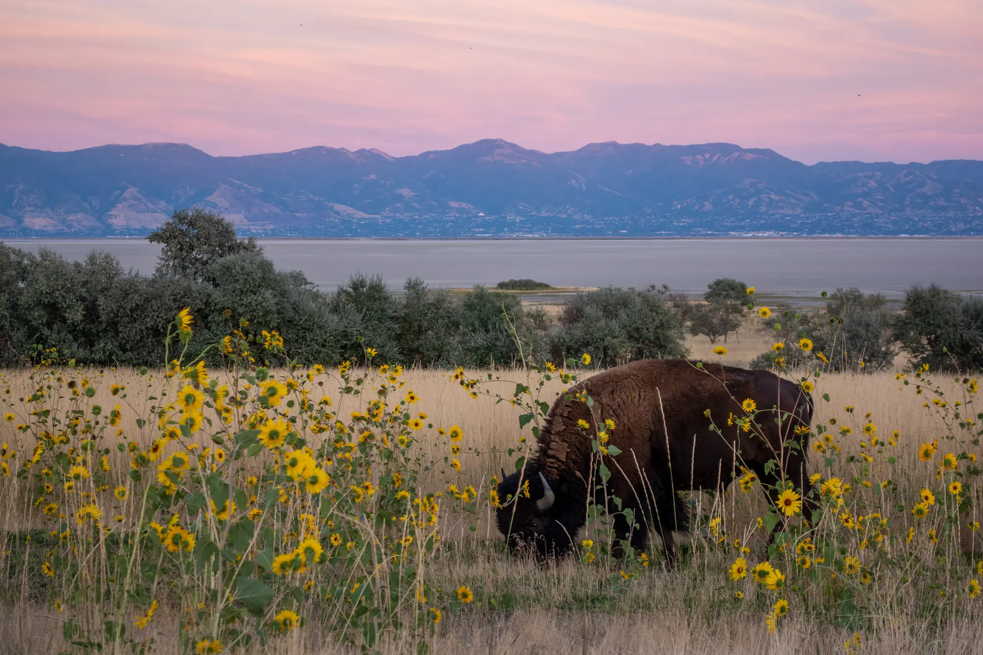
Antelope Island, the largest island in the lake and a state park, is the easiest place to see the shoreline for yourself. The photo at the top of this page was taken there. If you can add a few days and head south, Utah's red-rock canyons are the long-term record of what moving water does to rock over time. This list of cool summer canyon hikes with water running through them picks routes where you walk beside a creek rather than across bare slickrock, a good fit for a hot afternoon after a week of meetings.
What to watch from Oregon
- Lake levels after each winter. Utah's own site posts current conditions. A run of low snow years would put the lake back near its 2022 low within a few seasons.
- Whether saved water reaches the lake. Utah's experience with farm efficiency money is the best real-world test of the paper-versus-wet water problem.
- The USGS saline lakes results. The project plans more data releases in 2026, followed by final datasets and a synthesis report. Those findings will apply directly to Lake Abert, Summer Lake and Malheur Lake.
- Dust and snow. If early melt from lakebed dust becomes a regular pattern, it will shape how Western forecasters read the snowpack.
The archive's older posts tracked Western snowpack and the Eastern Snake Plain Aquifer for the same reason. What happens to water in a neighboring basin rarely stays there for long.
Questions people ask
How low did the Great Salt Lake get?
The State of Utah says the lake hit a new historic low in November 2022, covering only about 800 square miles, compared with roughly 1,700 square miles at its historic average elevation of 4,200 feet. Wikipedia, citing USGS records, gives the lowest recorded surface elevation as 4,188.5 feet on December 17, 2022.
Why is the Great Salt Lake shrinking?
It is a terminal lake: the Bear, Weber and Jordan rivers flow in and nothing flows out, so it loses about 2 million acre-feet a year to evaporation. Utah's strategic plan estimates human depletions in the basin at about 2.3 million acre-feet a year in 2017-2021, with agriculture the largest share, alongside drought and higher temperatures.
Does Oregon have lakes like the Great Salt Lake?
Yes, smaller ones. Lake Abert, Harney Lake, Malheur Lake, Silver Lake, Summer Lake and the Warner Lakes, plus Goose Lake on the California line, are among 20 Great Basin saline lakes the U.S. Geological Survey is studying alongside the Great Salt Lake.
What is the healthy level for the Great Salt Lake?
Utah's 2024 strategic plan puts the healthy range for both human and ecological interests between 4,198 and 4,205 feet above sea level. It estimates that filling the lake to 4,198 feet within 30 years would take 471,000 to 1,055,000 acre-feet a year of additional water.
Sources
- State of Utah, Great Salt Lake (official site): historic low levels, inflows, evaporation
- State of Utah, Great Salt Lake Strategic Plan (page)
- Office of the Great Salt Lake Commissioner, Great Salt Lake Strategic Plan (PDF, 2024)
- Wikipedia, Great Salt Lake
- USGS, Saline Lake Ecosystems IWAA Lakes (ver. 2.0, September 2026)
- USGS, 2025 in Review: The Saline Lake Ecosystems Integrated Water Availability Assessment (Jan. 22, 2026)
- Wikipedia, Lake Abert
- Western States Water Council, About WSWC
- Western States Water Council, Members
- Western States Water Council, Fall (211th) Meetings, Las Cruces, New Mexico (Oct. 21-23, 2026)
- Wikipedia, Salt Lake City International Airport